Wadesboro, NC – January 15, 2024
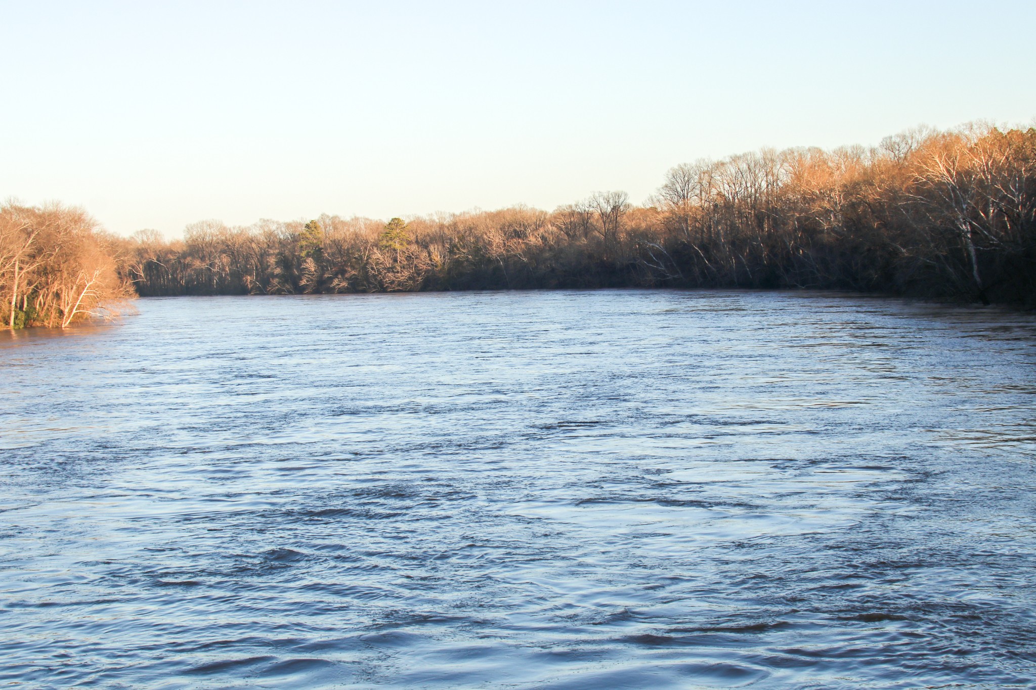
On Monday, January 8th, a powerful storm swept through the southeastern United States, bringing heavy rains, wind gusts, and high sustained winds from as far south as Atlanta, GA, to as far north as Norfolk, VA. The Pee Dee River, a vital waterway in the region, was one of the beneficiaries of the substantial rainfall, leading to significant changes in water levels and the surrounding landscape.
The Pee Dee River originates in the Appalachian Mountains of North Carolina, where its upper course, above the Uwharrie River, is known as the Yadkin River. The river’s name changes to the Pee Dee at its merger with the Uwharrie River. It travels southward, eventually merging with the Waccamaw River to form the Winyah Bay that empties into the Atlantic Ocean near Georgetown, SC.

This 232-mile-long river also known as the Great Pee Dee plays a crucial role in the region’s ecosystem and economy as it winds its way to the Atlantic Ocean.
As rain falls throughout the river basin, various creeks, branches and tributaries channel rainwater from its landing spot into the Pee Dee.
The National Oceanic and Atmospheric Administration (NOAA), a US Commerce Department tracks weather and rainfall through its National Weather Service (NWS).
The NWS provides weather, hydrologic, and climate forecasts and warnings for the United States, its territories, adjacent waters and ocean areas, for the protection of life and property and the enhancement of the national economy.
The widespread rain fall from Sunday, January 7th and Monday, January 8th caused the Pee Dee to swell. According to records of the NWS, rain fell from a high of 2.14” in Albemarle, NC to 1.5” in other areas of the Yadkin Pee Dee River basin.
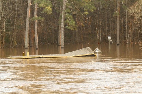
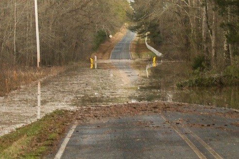
The heavy rain fall lead to increased water levels, causing flooding in low-lying areas along the riverbanks. Grassy Island Road in Anson County (also known as County Road 1634) that is less than five hundred yards from the Pee Dee in some areas in Anson County experienced some flooding from the Pee Dee. While many other low-lying bridges and roadways in Anson County experienced some flooding it may not have been a direct result of the higher water level of the Pee Dee. Conversely, those higher water levels most likely flowed into the Pee Dee.
Generally the chemical quality of the surface waters in the Yadkin-Pee Dee River basin is good. They are low in mineral matter and soft, although some of the surface water contains excessive quantities of iron.
Blewett Falls Lake borders Anson and Richmond counties and nearby Lake Tillery borders Montgomery and Stanly counties.

Lake Tillery in North Carolina has an average depth of 32 feet and a maximum depth of 72 feet. The lake is 29.934 miles long, has 104 miles of shoreline, and is 278 feet in elevation.
Lake Tillery is a manmade lake that was created in 1928 by damming the Yadkin and Pee Dee Rivers. The lake is a popular destination for fishing tournaments, water sports, and swimming. The lake is home to many fish species, including bass, catfish, crappie, and bream.
Blewett Falls Lake is a 2560-acre between Wadesboro, NC and Rockingham, NC. The lake is the storage reservoir for the Blewett Falls Hydroelectric Dam and is located at approximately mile 195 on the Pee Dee River between Anson and Richmond counties. The dam has a maximum height of about 50-feet above the river bed.
The Blewett Falls development began operation in 1912 and is owned and operated by Progress Energy. The surface area of Blewett Falls Lake covers about 2560 acres at the normal full pool elevation of 178 feet above mean sea level. At full pool elevation, the lake contains approximately 34 linear miles of shoreline.
There are six large hydroelectric dams along the Pee Dee River. The uppermost reservoir is W. Kerr Scott Dam and Reservoir. The other reservoirs are: High Rock Dam and Lake, Tuckertown Dam and Reservoir, Narrows Dam and Badin Lake, the Tillery Hydroelectric Plant Dam and Lake Tillery and The Blewett Falls Dam and Blewett Falls Lake.

The recent storm and heavy rainfall have highlighted the dynamic relationship between weather patterns and the Pee Dee River’s behavior. As communities along the riverbanks navigate the challenges posed by increased water levels and flooding, it underscores the importance of monitoring and managing these waterways. The Pee Dee River and its surrounding lakes continue to be integral to the region’s environment, economy, and recreation, showcasing the resilience and adaptability of communities in the face of natural forces.


This article really helped me to understand how the Pee Dee River was formed and its travels.